Transit and transport
JR Yamanote Line map (30 stations, loop, JY station numbering)
The Yamanote loop drawn with its thirty stations evenly spaced rather than to scale, each one carrying the lines you can change to
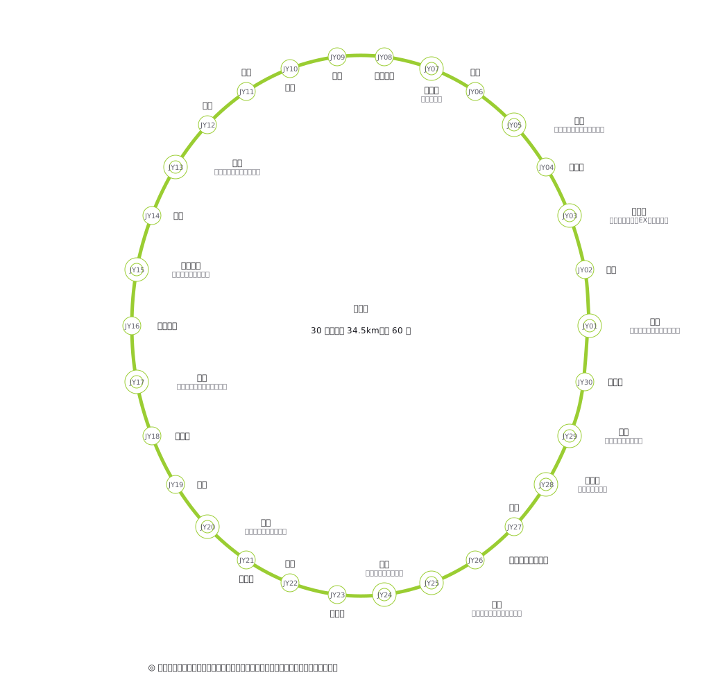
This drawing comes from one YAML file. No shape was moved by hand.
Notes in the source (in Japanese)
環状線なので 輪を閉じて描く(close: true)。順序は内回り(東京 → 神田 → …)。位置はおおよその方角に合わせてある(上野が北東、池袋が北西、品川が南)。
色は実在の路線色(うぐいす色 #9ACD32)。この色は白地に対して 1.88:1 で、zumen の下限 3:1 を割るので検証器が color-faint を出す —— それは正しい。実物も、白黒に落ちたら色では読めない。だから駅ナンバリング(JY01〜JY30)と駅名の両方が出ている。色だけに頼っていないことが、実物でも守られている。
駅名・乗換は事実。図そのものは zumen で描いたもので、どの事業者の図の写しでもない。
Source (YAML)
examples/gallery/78-山手線の路線図.zumen.yaml
More in this field
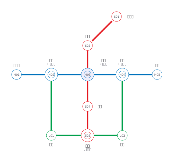 A fictional transit map of three lines told apart by colour and station numbering, drawn only in horizontal, vertical and 45° segments, with interchange stations marked by a double circle
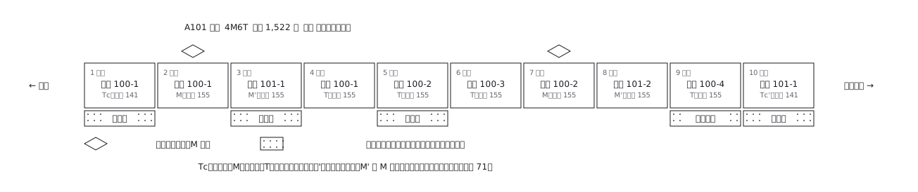 A ten-car commuter train set out car by car: which are motored and which are trailers, where the pantographs are, and what each car carries inside
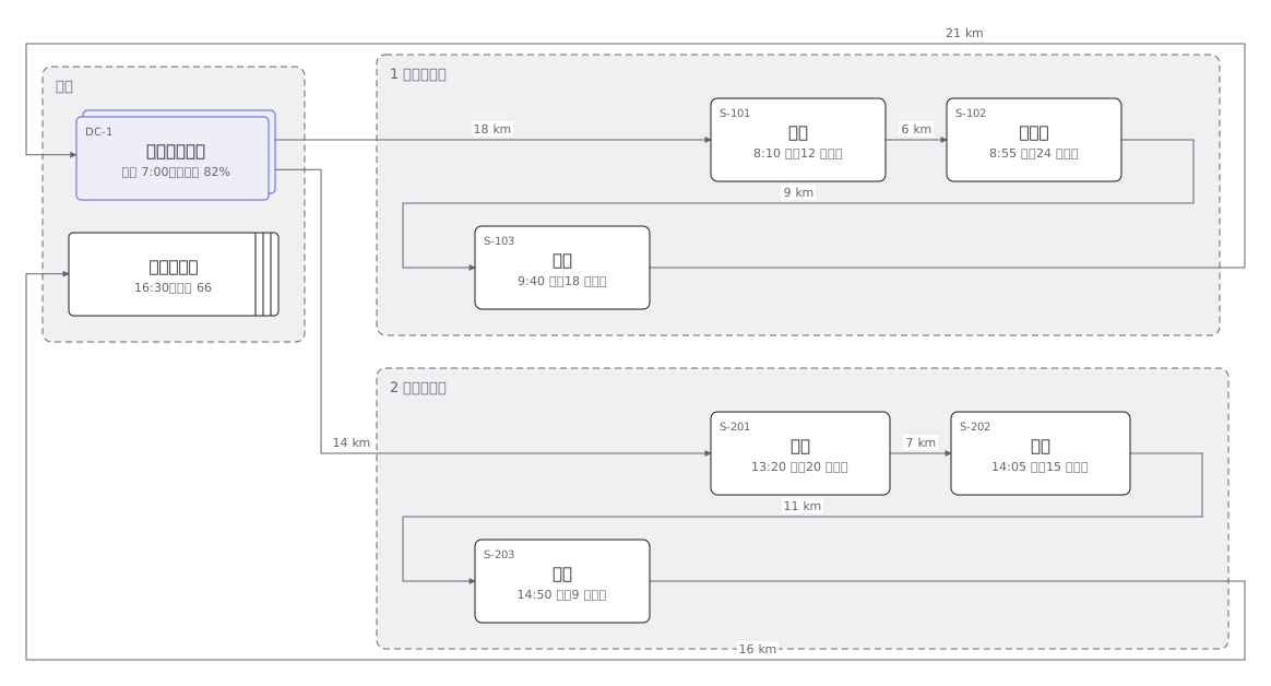 Delivery rounds for one two-tonne van split into a morning and an afternoon run: the order of calls and the stops themselves
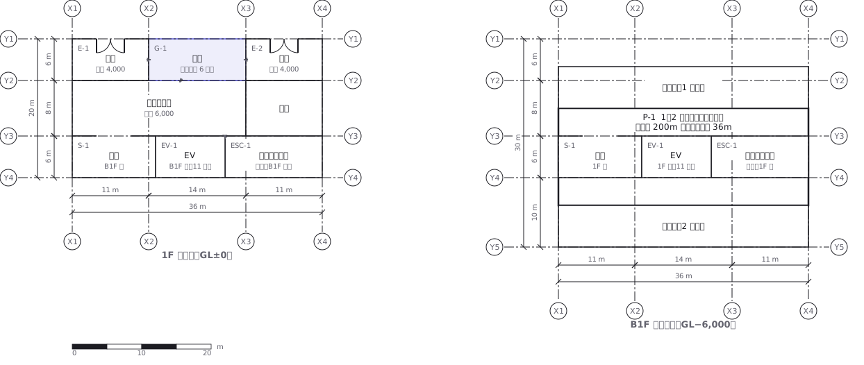 A station on two levels — ground floor and concourse — showing how the gates, stairs, lifts and exits line up with each other
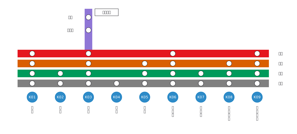 Stopping pattern chart: a band per service, a circle per stop
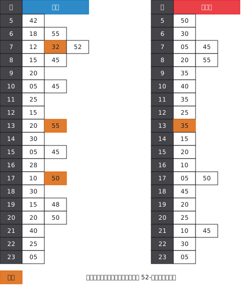 A station timetable with hours down the side and minutes across, weekday and weekend separated, and train types shown by symbol
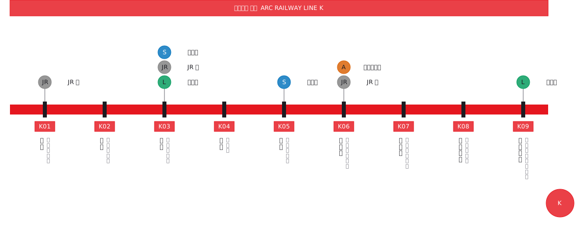 Interchange guide with station names set vertically
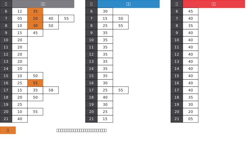 A bus stop timetable in three columns — weekday, Saturday, Sunday and holiday — with the departure minutes listed under each hour