Transit and transport
Fictional railway line map (Japanese style, station numbering, horizontal, vertical and 45-degree lines)
A fictional transit map of three lines told apart by colour and station numbering, drawn only in horizontal, vertical and 45° segments, with interchange stations marked by a double circle
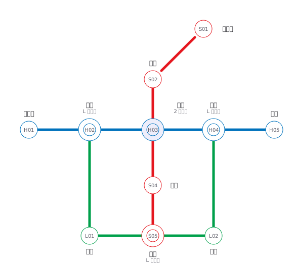
This drawing comes from one YAML file. No shape was moved by hand.
Notes in the source (in Japanese)
線の角度は水平・垂直・斜め 45 度のみ(日本の路線図の決まり)。色は路線の名前そのもの(DESIGN.md §7 の例外・src/palette.ts)。白黒でも読めるよう、色と駅ナンバリング(H / S / L)の両方で示す。
駅の間隔は等間隔で、実際の距離とは違う。路線図が答えるのは「どこで乗り換えるか」であって「何 km か」ではない ——距離を正しく描くと、都心の駅が団子になって乗換が読めなくなる。
角度を 3 つ(水平・垂直・45 度)に絞るのは、折れ点を減らすため。線が素直なほど、折れていない所=乗換駅が目に入る。駅ナンバリングは、色が読めない人にも、路線名を読めない人にも同じように効く。乗換駅は路線ごとに番号を持つ(中央は H03 と S03)が、この図では丸に 1 つだけ書いた。◎ は 2 路線以上が止まる駅(桜台・中央・川手・港南)。
Source (YAML)
examples/gallery/25-路線図.zumen.yaml
More in this field
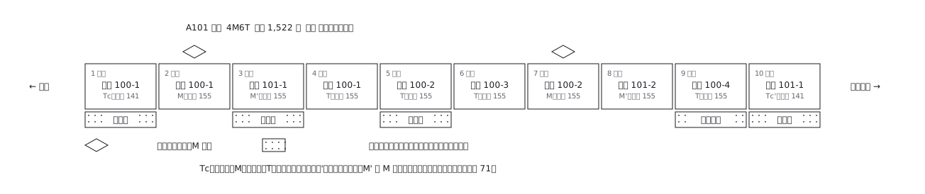 A ten-car commuter train set out car by car: which are motored and which are trailers, where the pantographs are, and what each car carries inside
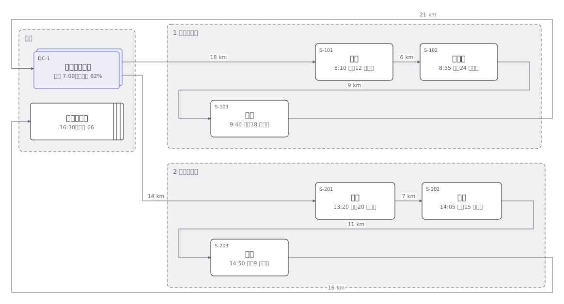 Delivery rounds for one two-tonne van split into a morning and an afternoon run: the order of calls and the stops themselves
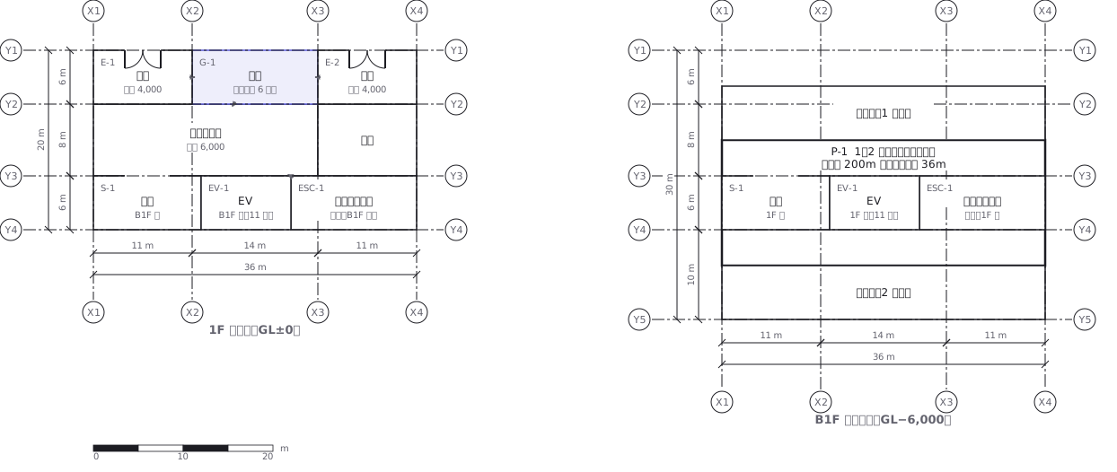 A station on two levels — ground floor and concourse — showing how the gates, stairs, lifts and exits line up with each other
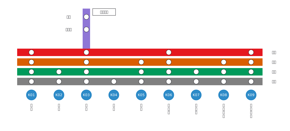 Stopping pattern chart: a band per service, a circle per stop
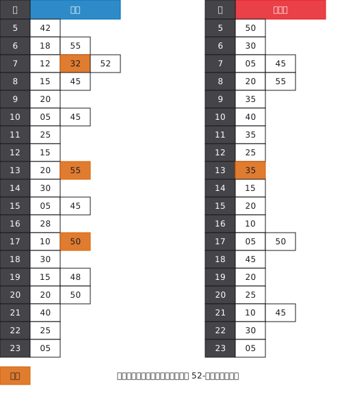 A station timetable with hours down the side and minutes across, weekday and weekend separated, and train types shown by symbol
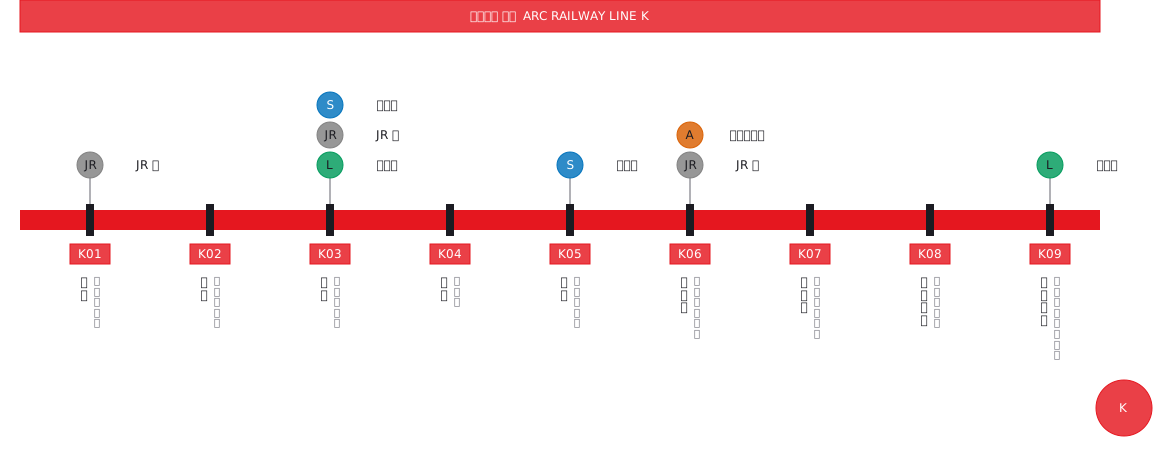 Interchange guide with station names set vertically
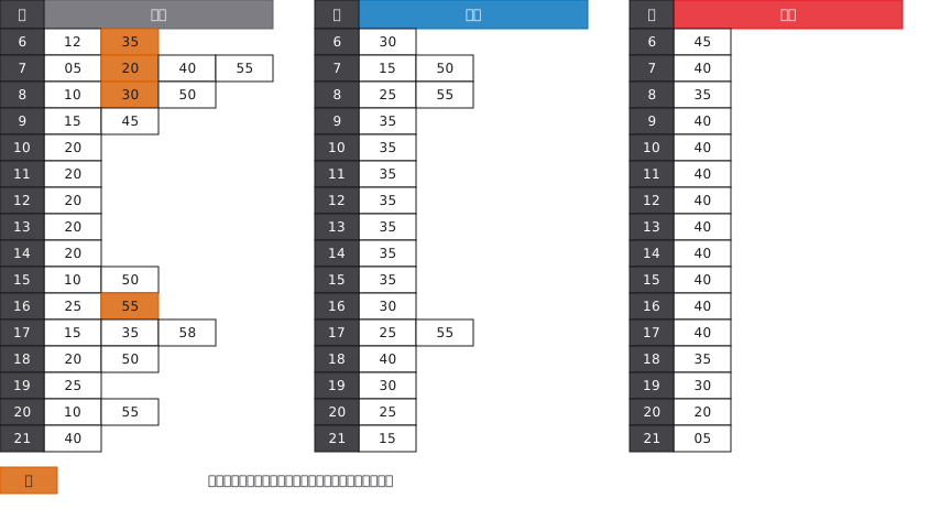 A bus stop timetable in three columns — weekday, Saturday, Sunday and holiday — with the departure minutes listed under each hour
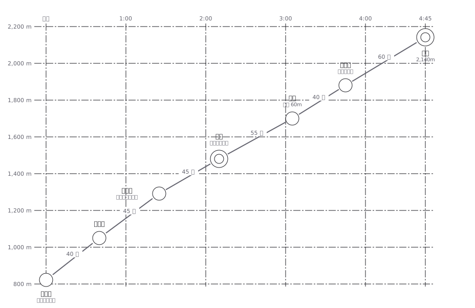 A hiking profile with distance across and elevation up, annotated with how long each section takes to walk