Transit and transport
Drone flight plan (solar plant inspection, not a specified flight — Category I)
Drone flight plan and the area kept clear of people
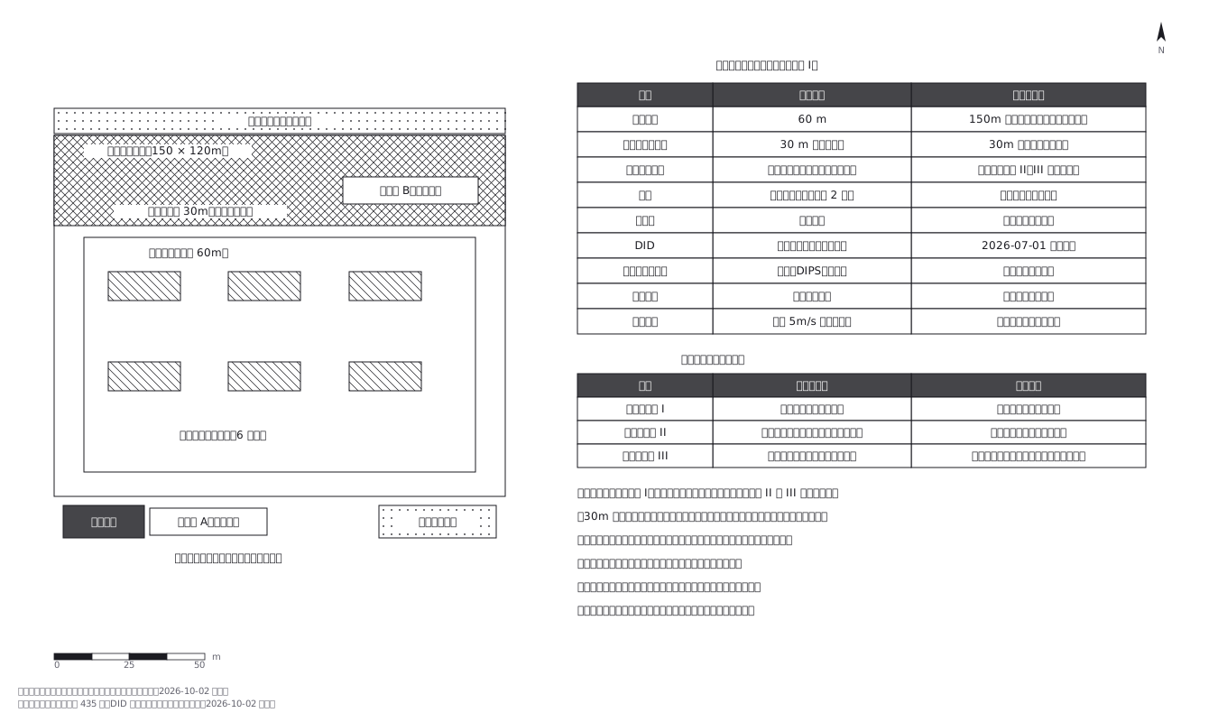
This drawing comes from one YAML file. No shape was moved by hand.
Notes in the source (in Japanese)
1 px = 300 mm。飛ばす範囲と、人を入れない範囲の図。
航空法のカテゴリーは、機体の性能ではなく飛ばし方で決まる。特定飛行(150m 以上・空港周辺・DID の空域、夜間・目視外・30m 未満・催し・危険物・投下の方法)に当たらなければカテゴリー I で、許可・承認は要らない。この点検は 60m・DID 外・日中・目視内・30m 以上なのでカテゴリー I。特定飛行になったとき、飛行経路の下に人が入らないようにできているか(立入管理措置)で II と III が分かれる。ロープ・看板・入口の補助者は、ここでは義務ではないが自主的に取っている。出典:国土交通省「無人航空機の飛行許可・承認手続」https://www.mlit.go.jp/koku/koku_fr10_000042.html/ DID からの工業専用地域の除外は国土交通省告示第 435 号(2026-07-01 適用)(取得 2026-10-02)。
第三者と、第三者の物件から 30m。関係者は第三者ではない。この図では公道側に 30m の帯を取って、そこへは入れない。
離発着点と緊急着陸地点は別に取る。帰れなくなったときに降ろす場所がいる。
場所は架空。法令は改正されるので、飛ばす前に必ず最新を確認すること。
Source (YAML)
examples/gallery/102-ドローンの飛行計画図.zumen.yaml
More in this field
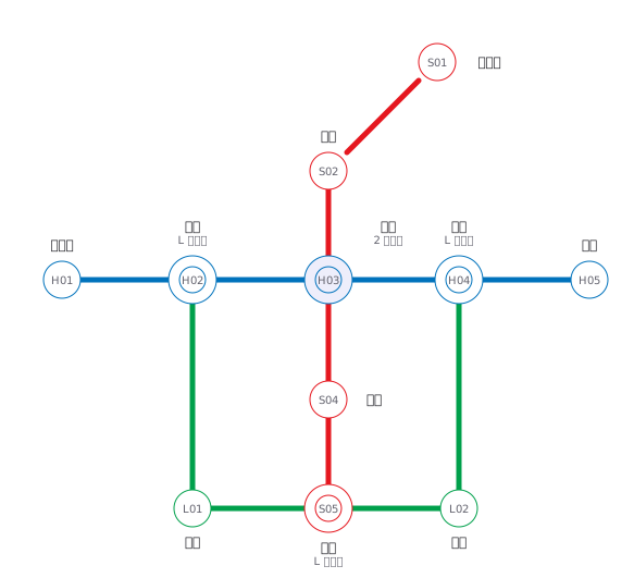 A fictional transit map of three lines told apart by colour and station numbering, drawn only in horizontal, vertical and 45° segments, with interchange stations marked by a double circle
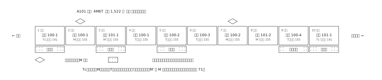 A ten-car commuter train set out car by car: which are motored and which are trailers, where the pantographs are, and what each car carries inside
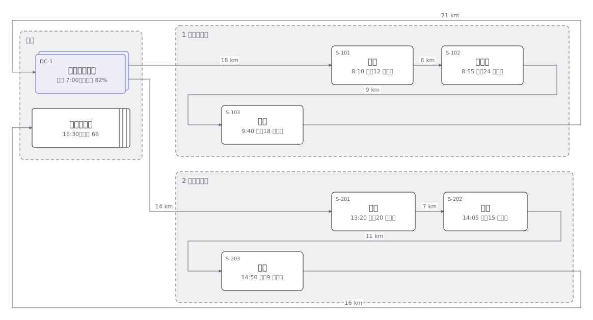 Delivery rounds for one two-tonne van split into a morning and an afternoon run: the order of calls and the stops themselves
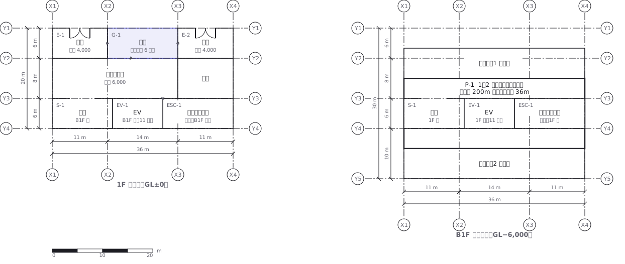 A station on two levels — ground floor and concourse — showing how the gates, stairs, lifts and exits line up with each other
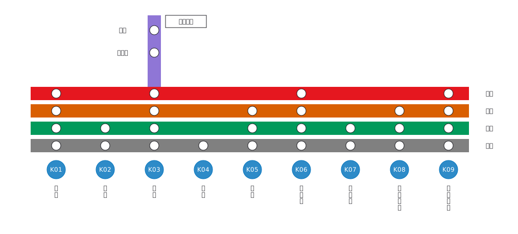 Stopping pattern chart: a band per service, a circle per stop
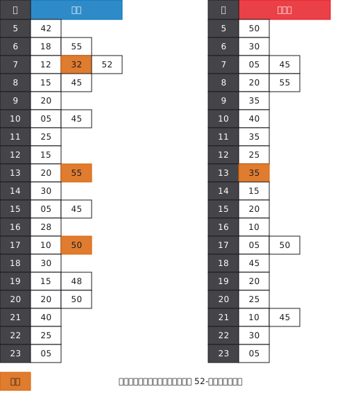 A station timetable with hours down the side and minutes across, weekday and weekend separated, and train types shown by symbol
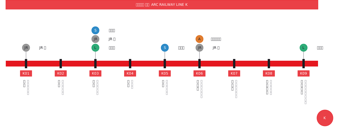 Interchange guide with station names set vertically
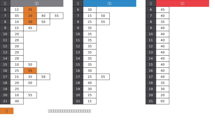 A bus stop timetable in three columns — weekday, Saturday, Sunday and holiday — with the departure minutes listed under each hour