Services and electrical
Reading a nautical chart — datums, distances, light characters and buoyage
A nautical chart carries three datums at once: depths from the lowest water, clearances from the highest, and light heights from the mean — each taken at its worst case
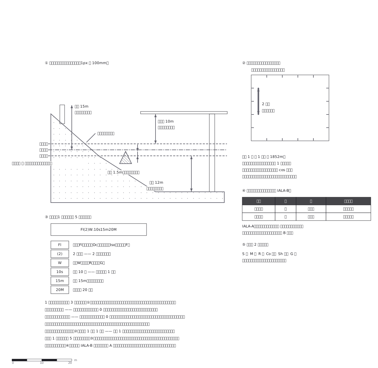
This drawing comes from one YAML file. No shape was moved by hand.
Notes in the source (in Japanese)
1 枚の海図に、基準面が 3 つある。
水深は最低水面から、橋の桁下高と海岸線は最高水面から、灯台の高さは平均水面から。深さと高さを別の面から測るのは、それぞれ「いちばん危ないとき」を取るため。
距離は縦(緯度)の目盛りで測る —— 緯度 1 分 = 1 海里 = 1852m。メルカトル図法なので、経度 1 分は緯度が高いほど短くなる。
入港するとき右が赤(日本は IALA-B)。欧州の A 方式とは左右が逆。
Source (YAML)
examples/gallery/223-海図の読み方.zumen.yaml
More in this field
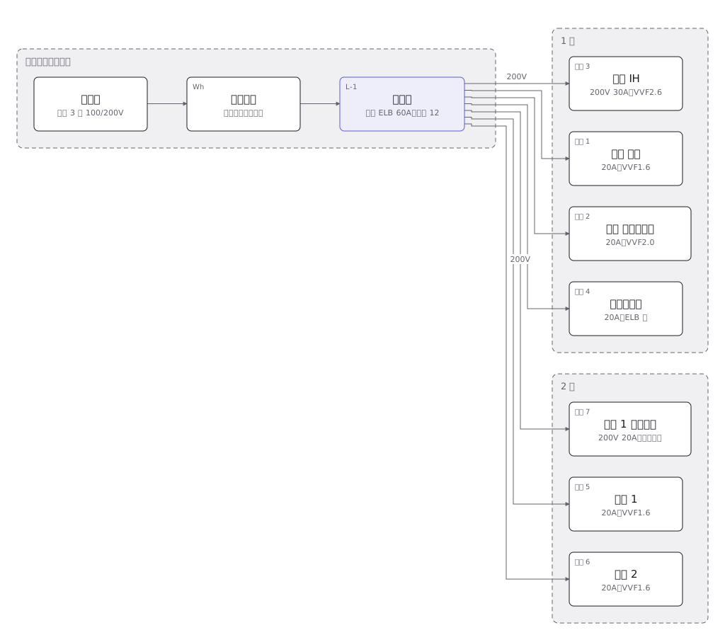 A house wiring layout from the service entrance to the consumer unit, then breaker by breaker to the sockets and lights in each room
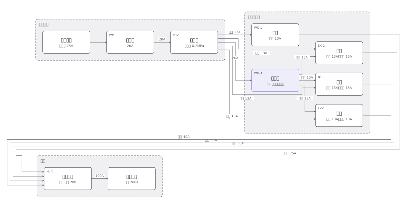 The four plumbing systems of a house — cold supply, hot supply, drainage and venting — separated out fixture by fixture
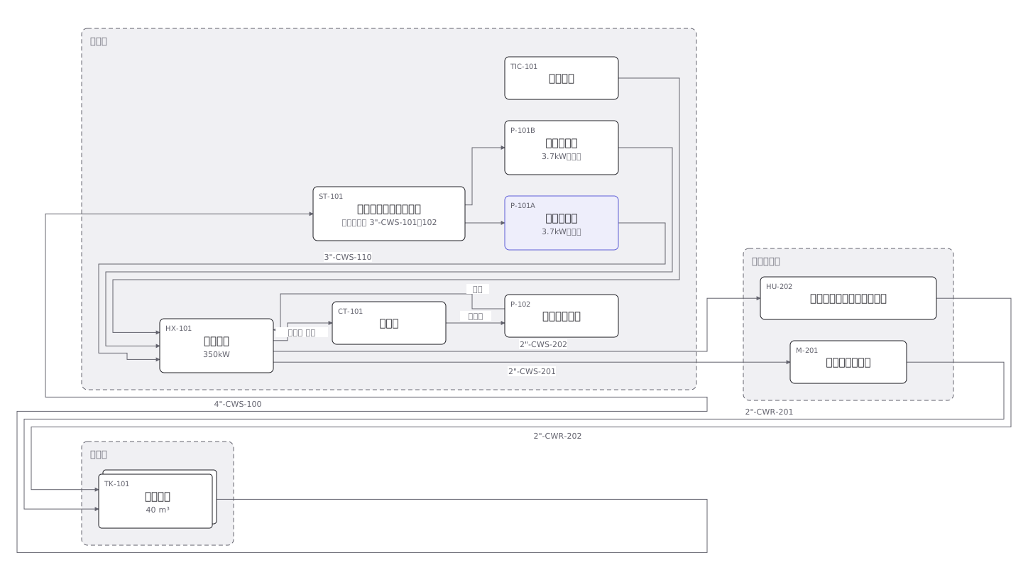 A cooling water P&ID where pumps, heat exchangers, valves and instruments are joined by pipes distinguished by line type
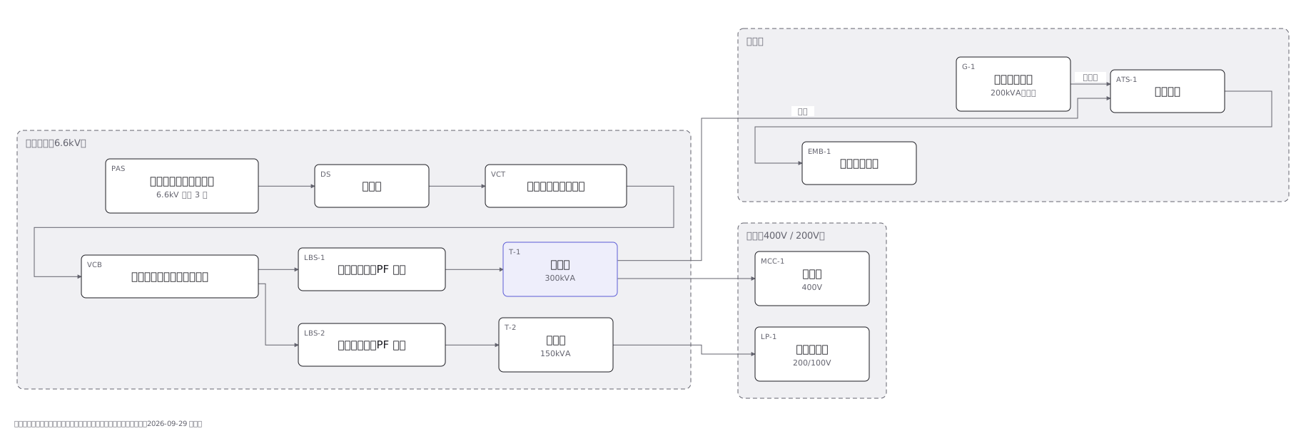 A substation single-line diagram from the incoming supply through disconnector, breaker and transformer to the low voltage boards
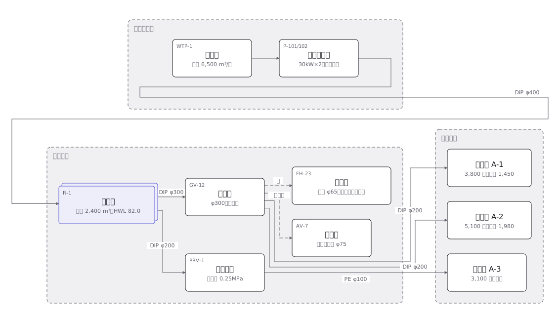 A town water distribution network from treatment works through service reservoirs and trunk mains to each supply zone, with the ground level of every zone
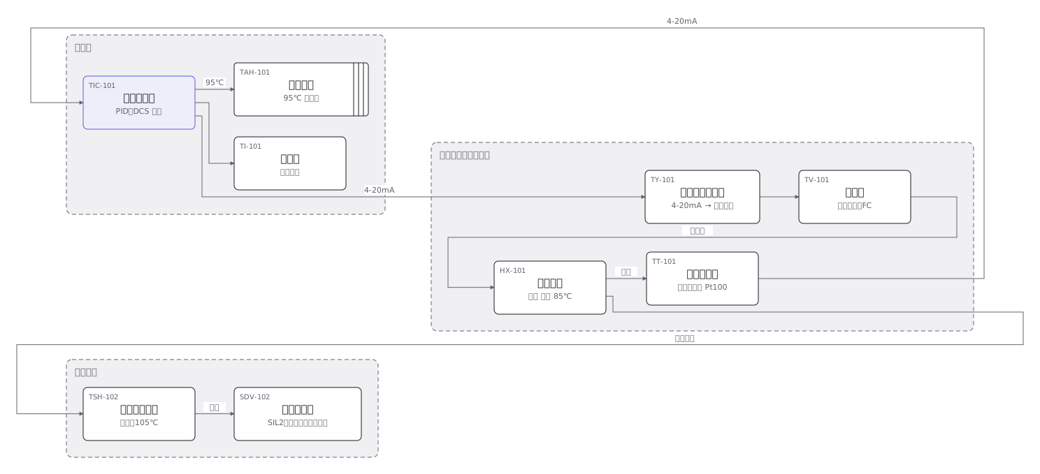 An instrument loop from sensing element through transmitter and controller to final element, every device carrying its ISA tag
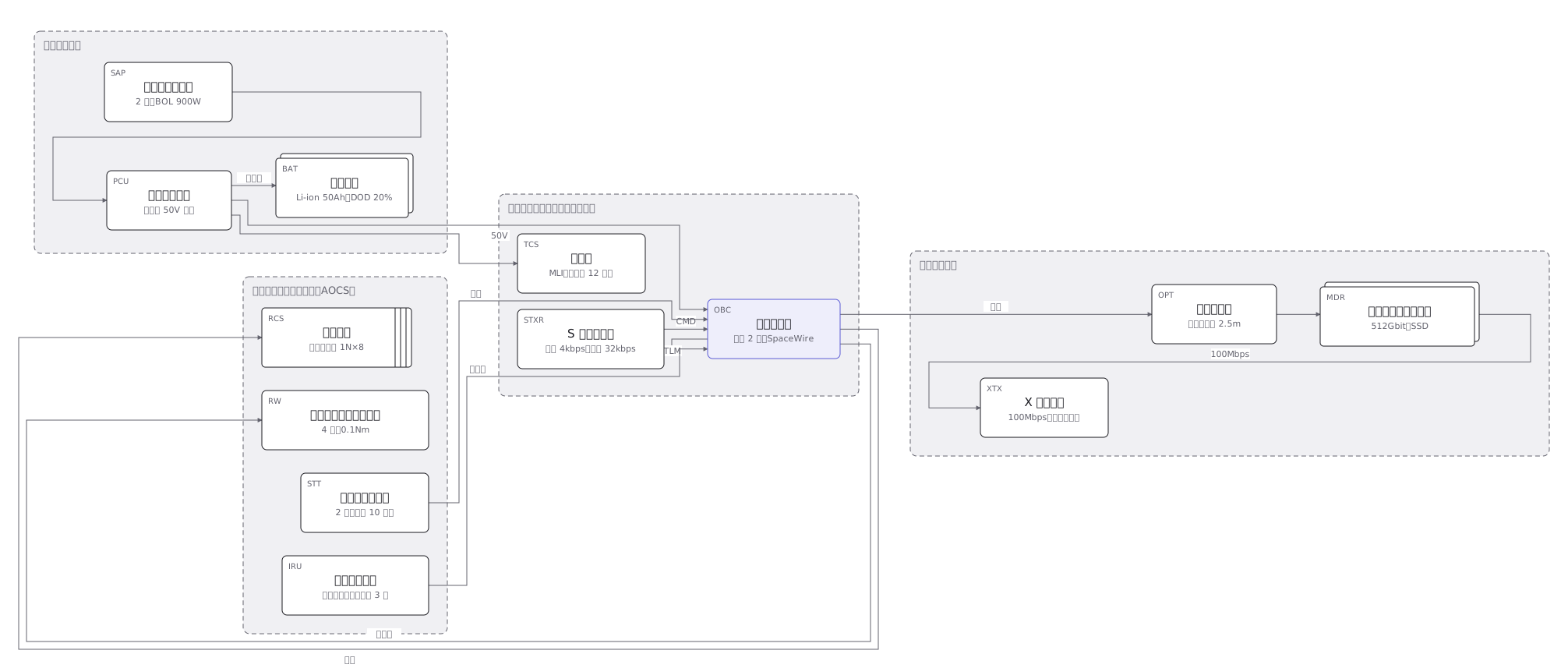 The subsystems of a 150kg satellite and how they connect: power, communications, attitude control, data handling and the mission payload
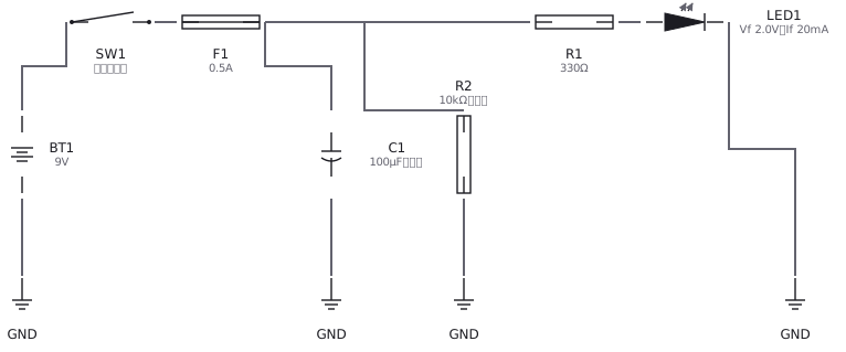 An LED circuit drawn with IEC and JIS symbols: supply, resistor, LED and switch