Disaster and emergency
Disaster damage certification for housing — where to measure from
Damage certification: a hazard map measures from the ground, this measures from the floor — so the same water gives two different numbers, and 0.1m changes the category
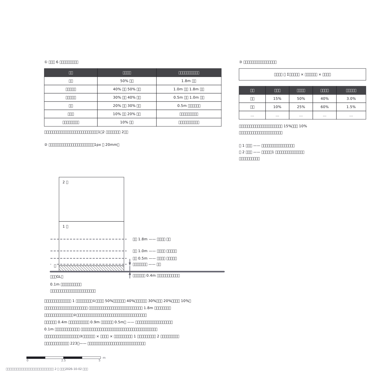
This drawing comes from one YAML file. No shape was moved by hand.
Notes in the source (in Japanese)
ハザードマップは地面から、罹災証明は床から測る。
区分は損害割合 1 つで決まる(全壊 50%/大規模半壊 40%/中規模半壊 30%/半壊 20%/準半壊 10%)。水害では浸水深がそのまま区分になり、床上 1.8m 以上で全壊(外壁や建具が一定の被害を受けた一戸建て木造)。
0.1m 違うと区分が変わる。 床が地面より 0.4m 高い家なら、地面から 0.9m の水が「床上 0.5m」—— 中規模半壊の境目にちょうど乗る。
出典は内閣府「災害に係る住家の被害認定基準運用指針」第 2 編 水害(r605shishin_3.pdf、https://www.bousai.go.jp/taisaku/unyou.html から取得、2026-10-02)。浸水深の表は 2 つある:外壁と建具が壊れたとき(表 2)は 1.8m 全壊/1.0m 大規模半壊/0.5m 中規模半壊/床上 半壊/床下 一部損壊。壊れていないとき(表 1)は 1 段ずつ軽く、1.8m 大規模半壊/1.0m 中規模半壊/0.1m 半壊/0.1m 未満 準半壊。この図の①②は表 2 を描いた。
Source (YAML)
examples/gallery/224-罹災証明の住家被害認定.zumen.yaml
More in this field
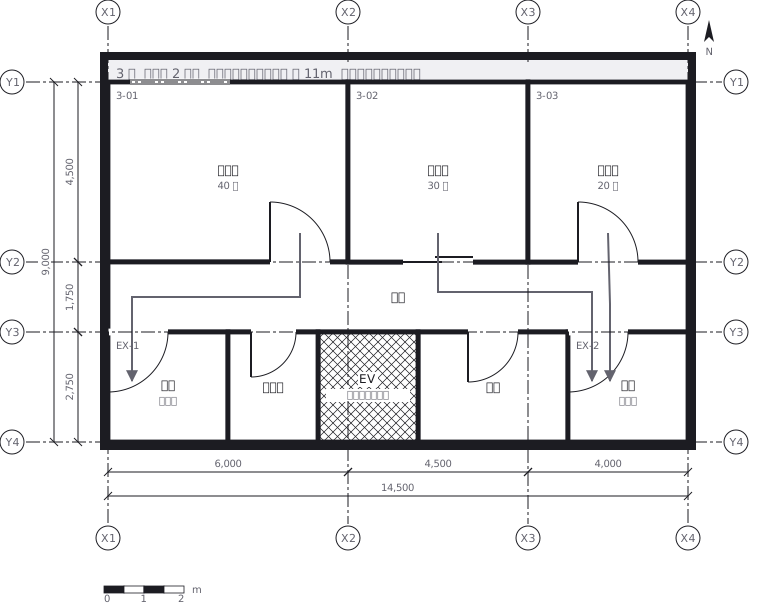 Escape routes on a third floor: two ways out of every room to a staircase, with the travel distance and the fire doors and extinguishers along the way
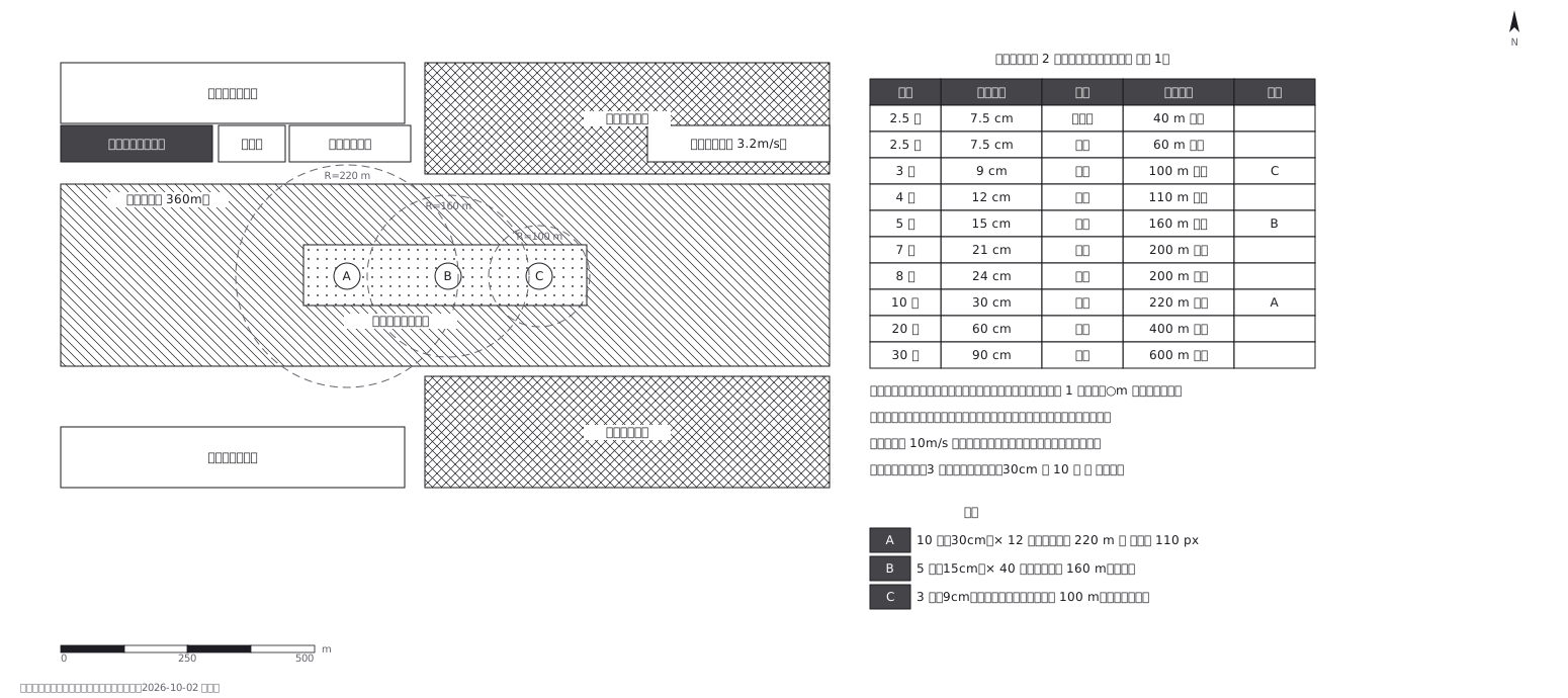 Fireworks safety distances, a circle per shell size
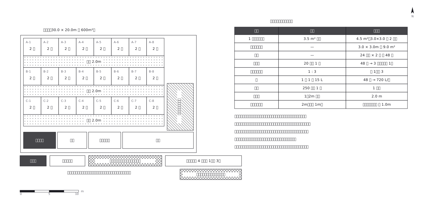 Shelter layout: 3.5 sq m a person, and how many toilets
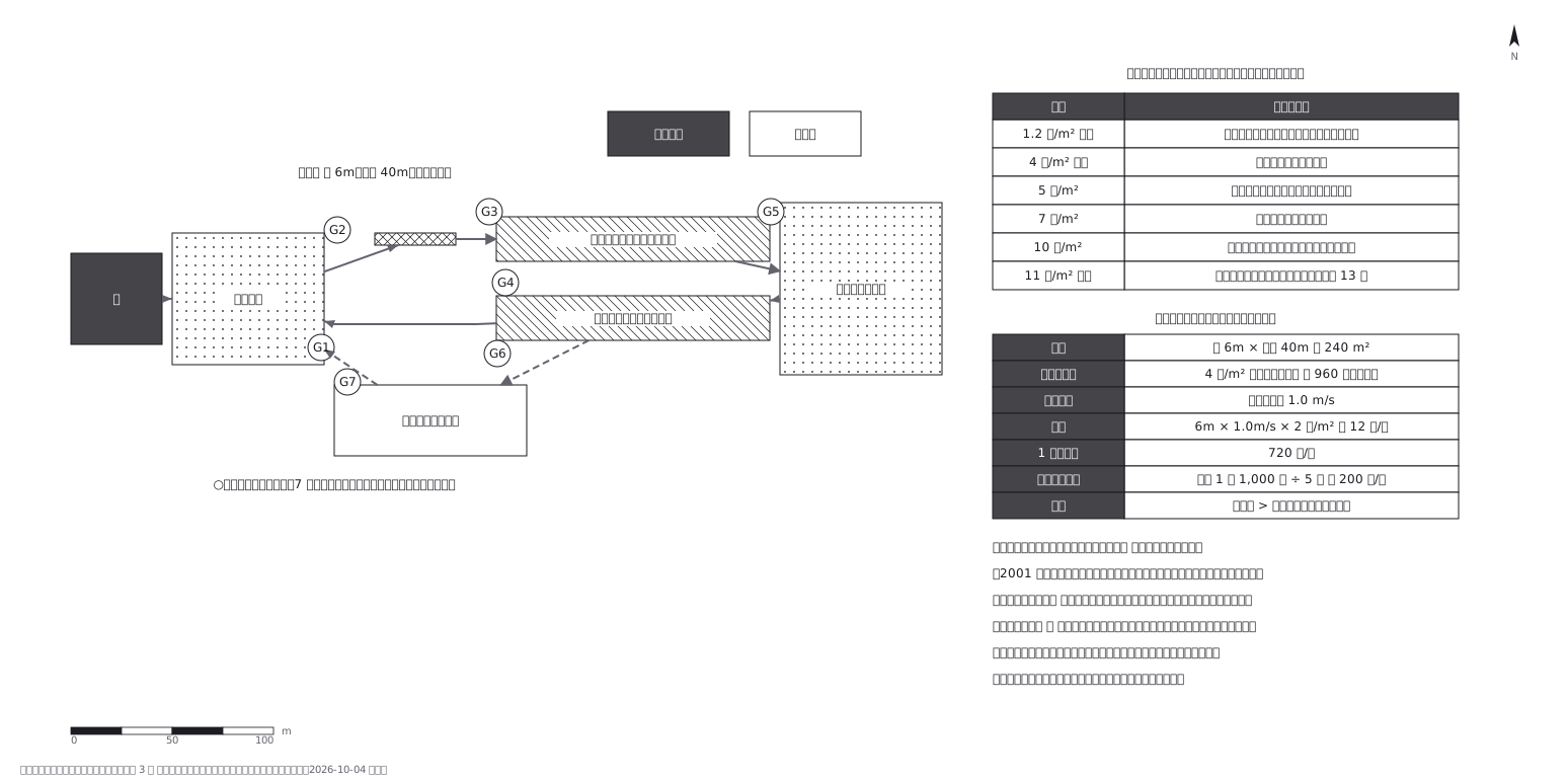 Crowd plan: how many can flow out against how many come in
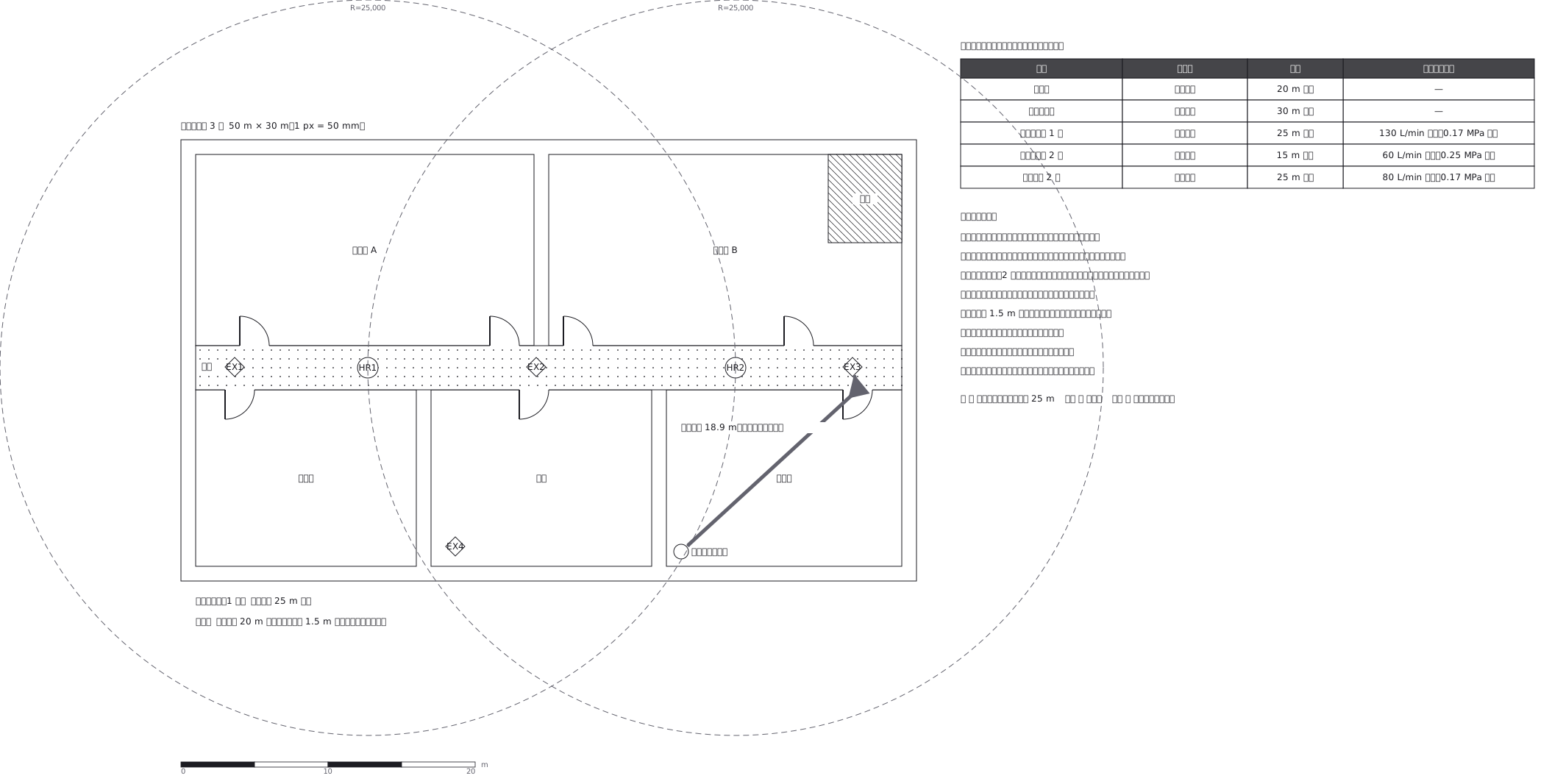 Extinguishers and hose reels, measured two different ways
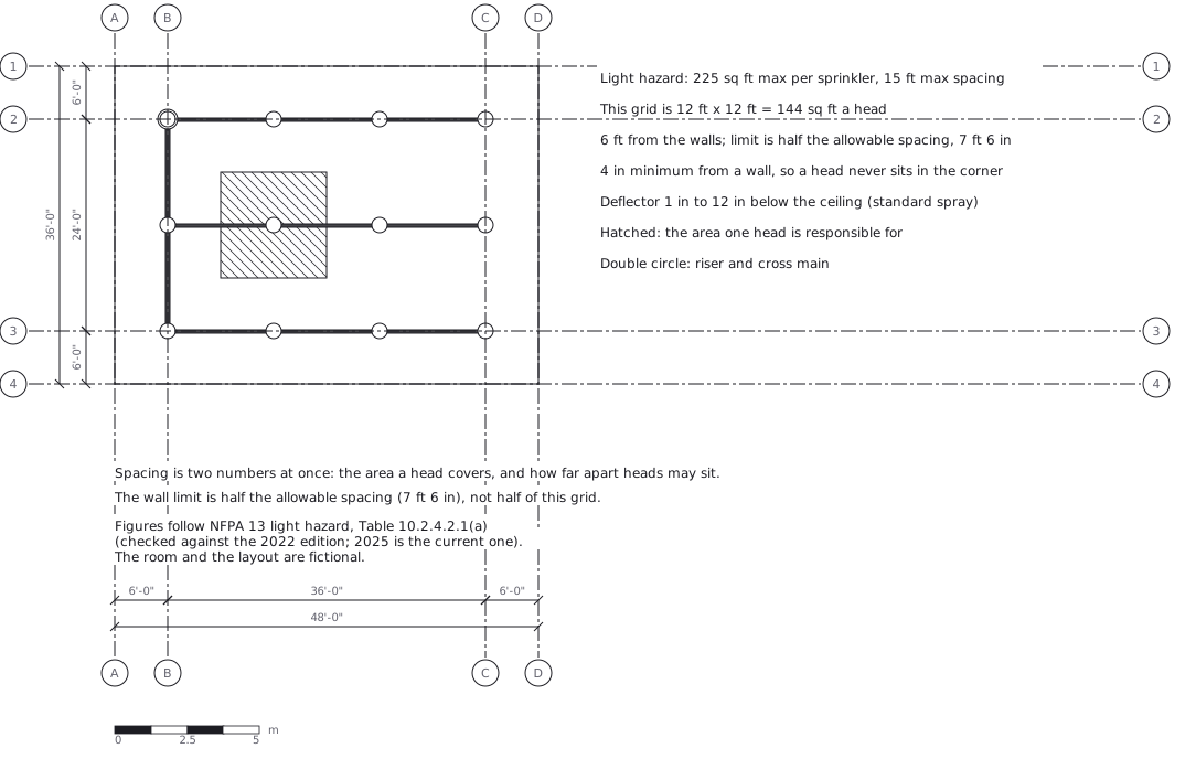 Sprinkler layout: area per head and spacing, decided together
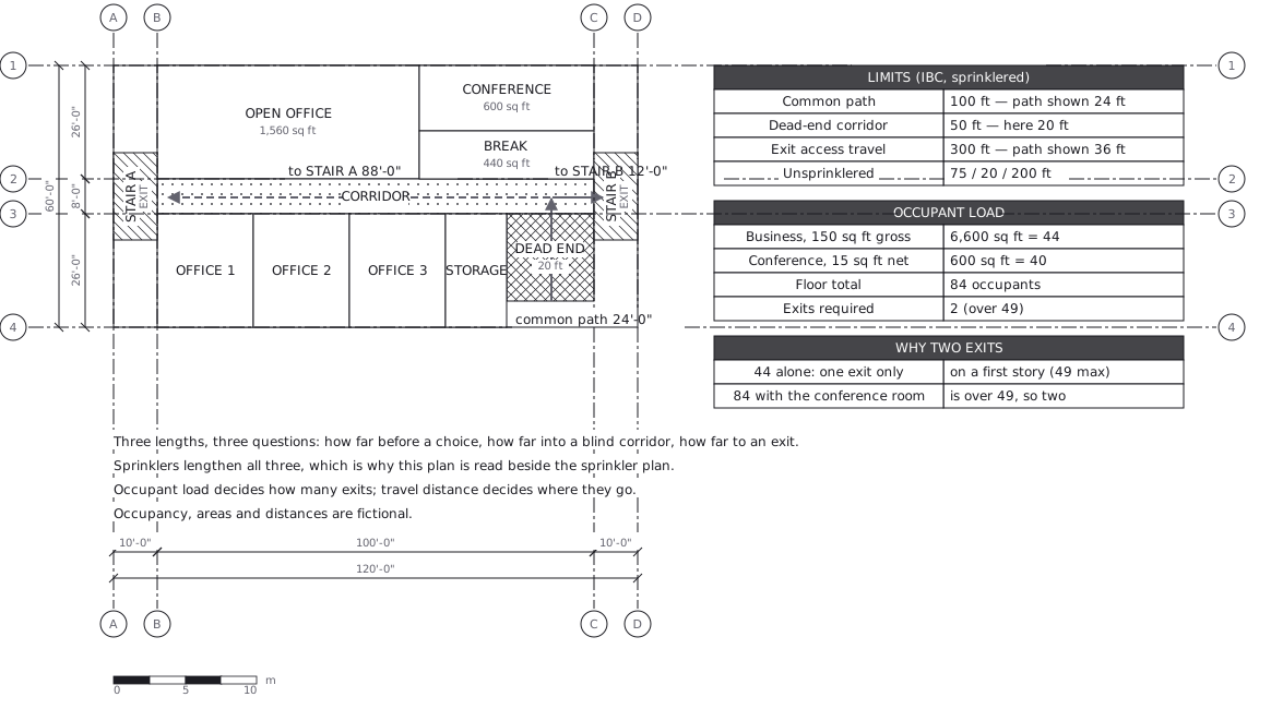 Egress plan: three lengths answering three questions
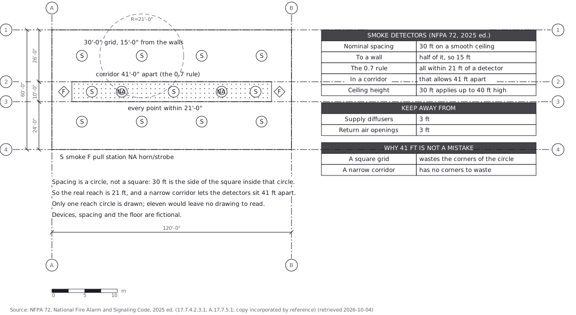 Fire alarm devices: spacing is a circle, not a square