防災・災害
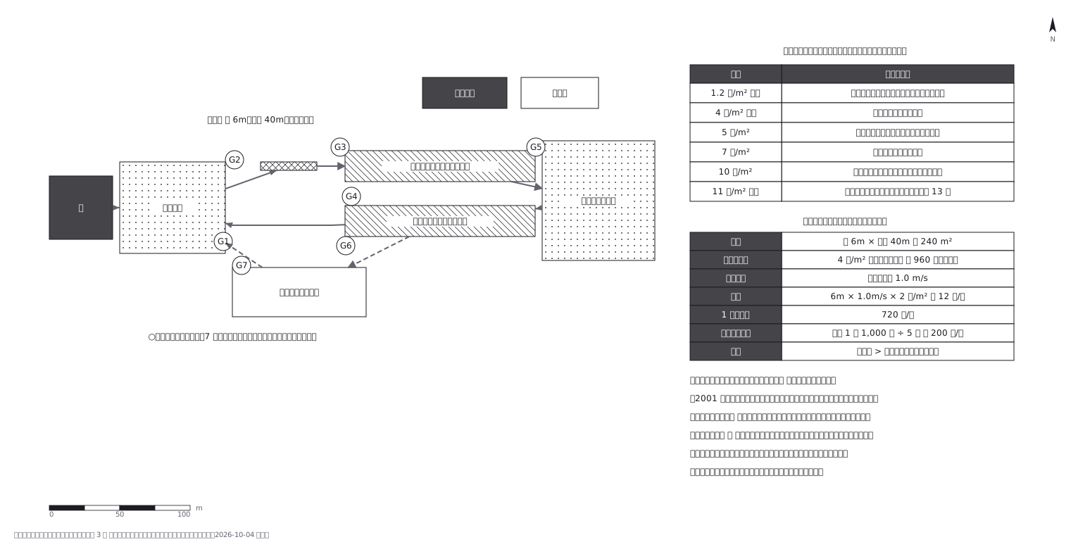
Wildland fire IAP map (fictional)
林野火災の作戦図(火の絵ではなく、逃げ道が書いてある紙)
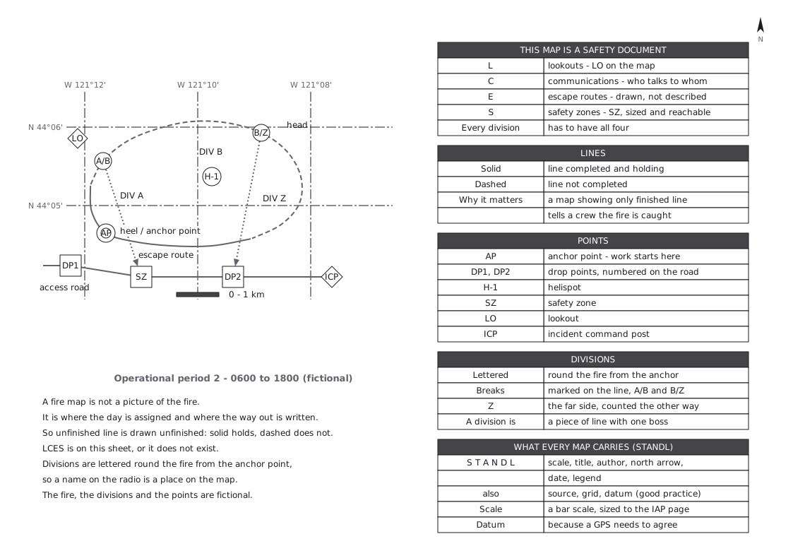
この図は、下の 1 枚の YAML から描かれています。手で図形を動かしてはいません。
正本に書いてある決まりごと
A fire map is not a picture of the fire.
It is where the day is assigned and where the way out is written. So theline that is not finished is drawn as not finished - solid where it holds,dashed where it does not. A map that shows only completed line tells a crewthe fire is caught.
LCES is not a poster. Lookouts, communications, escape routes and safetyzones are on this sheet, or they do not exist. Divisions are lettered roundthe fire from the anchor point, so a name on the radio is a place on the map.
Every map product carries STANDL - scale, title, author, north arrow,date, legend. Source, grid and datum (SGD) are added here as good practice;that addition was not checked against the standard itself. IAP maps carry a bar scale and are sizedto the IAP page; there is no one fixed scale.Grid: 2' of longitude = 160 px and 1' of latitude = 111 px, the ratio at 44°N(cos 44.1° = 0.718), so the bar scale below holds in both directions:2' of longitude there is 2.66 km, so 1 km = 60 px.Escape routes are dotted with an arrow, so they cannot be read as unfinished line.STANDL follows NWCG PMS 936 (Standards for Geospatial Operations), checked 2026-10-02.
The fire, the divisions and the points are fictional.
正本(YAML)
examples/gallery/159-Fire-IAP-map.zumen.yaml