Building and civil
Metes and bounds plat (fictional)
A deed describes land as a walk, not a picture
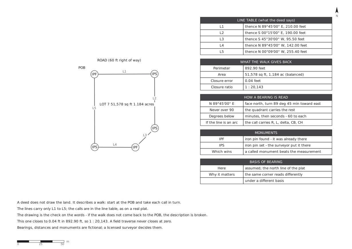
This drawing comes from one YAML file. No shape was moved by hand.
Notes in the source (in Japanese)
A deed does not draw the land. It describes a walk.
Start at the point of beginning, take each call in turn - a bearing and adistance - and the last one has to bring you back. The drawing is the checkon the words: if the calls do not close, the description is broken.
A bearing is never over 90 degrees. It is read from north or from south,turned toward east or west, so the quadrant letter carries the rest:N 89°45'00" E is "face north, turn 89 degrees 45 minutes toward east".
This parcel closes to 0.04 ft in 892.90 ft (1 : 20,143) because it wascomputed rather than walked. A field traverse never closes at zero - theratio is how a survey says how well it closed.
1 px = 1 ft. Bearings, distances and monuments are fictional.
Source (YAML)
examples/gallery/156-Metes-and-bounds-plat.zumen.yaml
More in this field
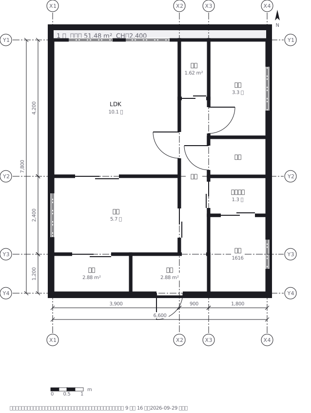 A two-bedroom apartment plan with room dimensions, which way each door swings, and where the wet rooms and storage sit
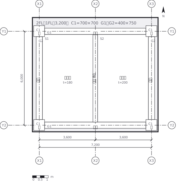 A reinforced concrete framing plan for a second floor, with the grid lines and the mark of every column, girder, beam and slab
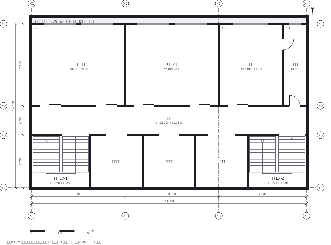 School floor plan (walls, door swings, grid lines, dimensions)
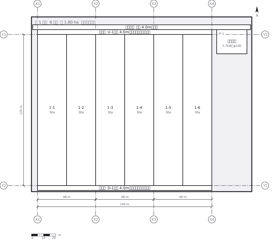 A farmland consolidation plan laying out 30-are plots, with the irrigation channels, the drainage channels and the farm roads that serve them
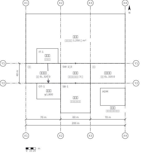 The plan of a concrete gravity dam: the body, the spillway, the intake works and the access road for maintenance
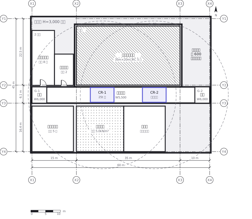 Site logistics plan with the crane radius
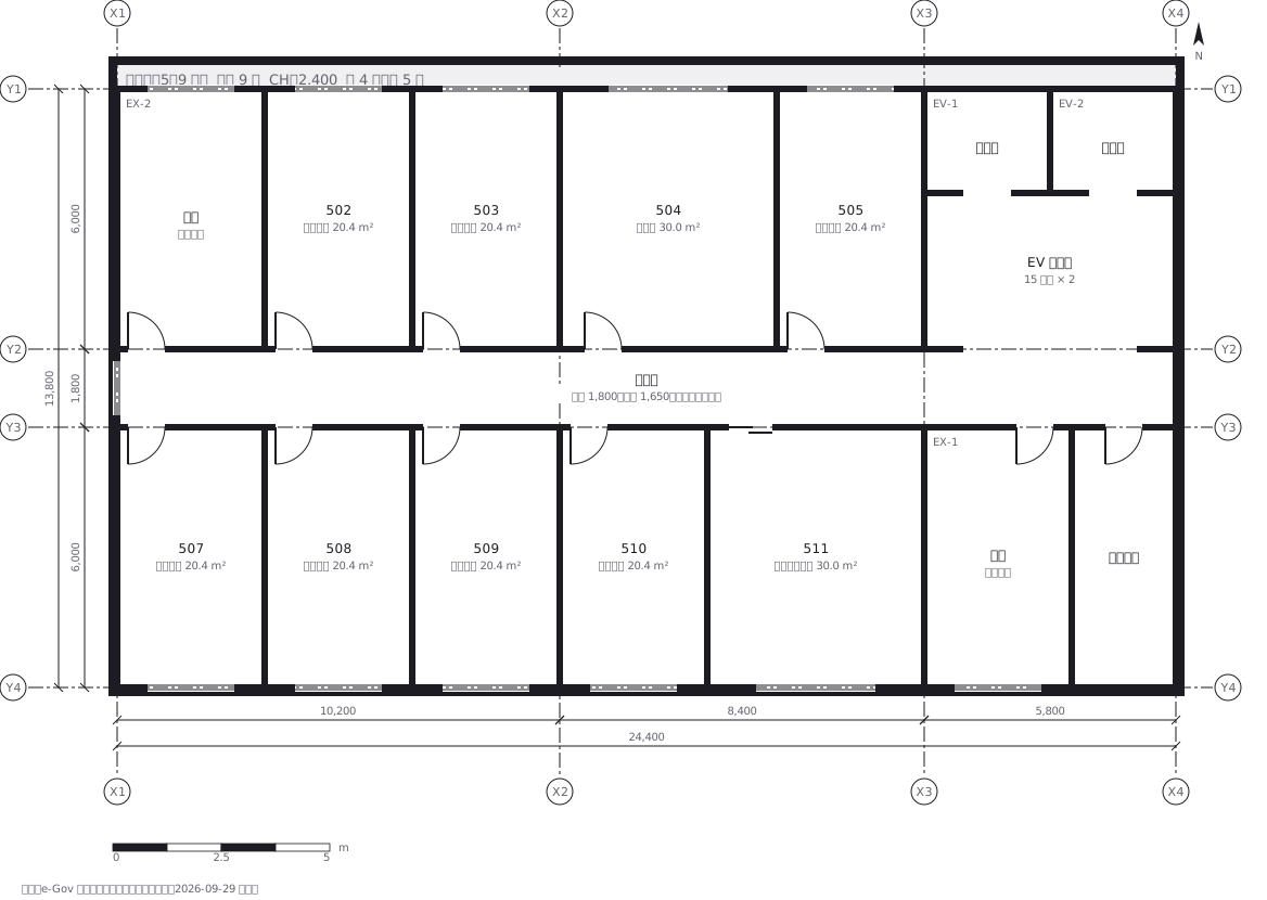 The typical floor of a business hotel with nine rooms, a central corridor, two direct stairs, and two lifts with their hall
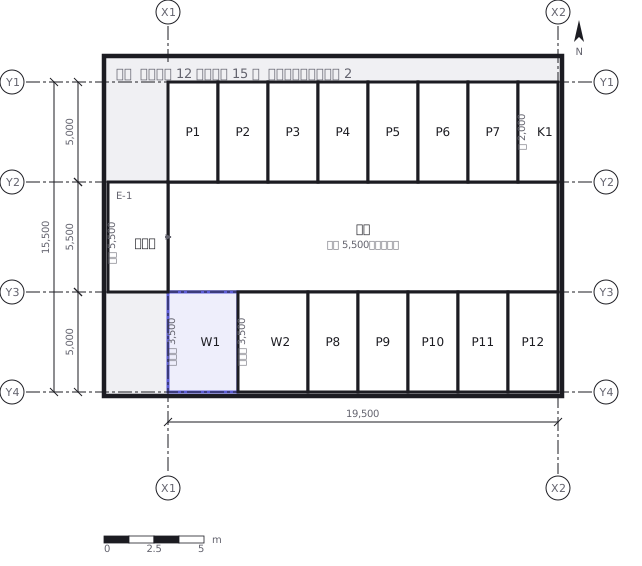 A surface car park set out for fourteen cars, with bay dimensions, aisle width and where the entrance and exit sit