Disaster and emergency
Typhoon track forecast (forecast circle and storm warning area — fictional)
A typhoon forecast: the circle is where the centre lands 70% of the time
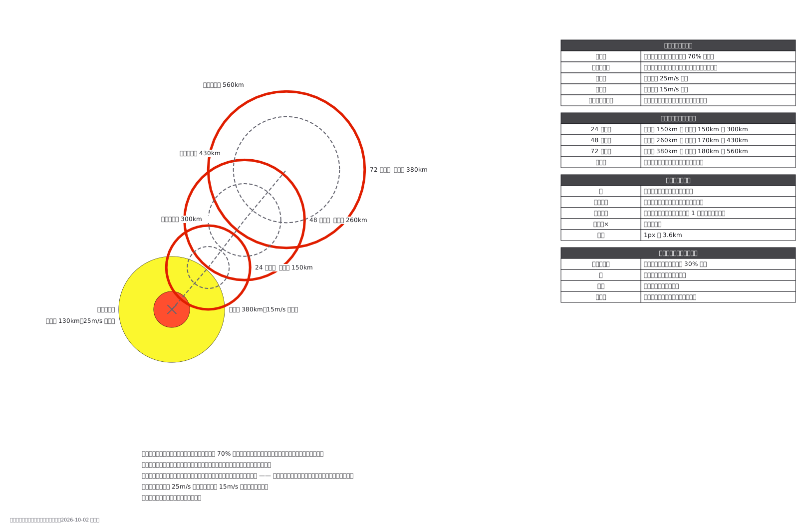
This drawing comes from one YAML file. No shape was moved by hand.
Notes in the source (in Japanese)
予報円は「中心が入る確率 70%」の範囲。 台風が円に収まる意味ではない。
暴風警戒域は、予報円を暴風域の半径ぶん太らせた形 ——中心が予報円のどこへ進んでも暴風域に入りうる範囲、という意味。暴風域は平均風速 25m/s 以上、強風域は 15m/s 以上。
色は暴風域と強風域だけに敷く(気象庁の図と同じ考え)。線の種類も気象庁の台風経路図にそろえた:予報円は破線、暴風警戒域は実線。気象庁の図では暴風警戒域を時刻ごとの円にせず、外側を 1 本の線でつないで描く(この図は作られ方を見せるため、時刻ごとの円のまま残した)。海岸線の上で、暴風警戒域を気象庁と同じく 1 本の線で包んだ図は見本 392。色は気象庁の配色指針 表 1-2(暴風域 255,40,0・強風域 250,245,0)、暴風警戒域は赤の実線(2026-10-15 に直した)。出典:気象庁「台風経路図の見方」https://www.jma.go.jp/jma/kishou/know/typhoon/7-1.html(取得 2026-10-02)。1px = 3.6km。台風・進路・数値は架空。
Source (YAML)
examples/gallery/183-台風の進路予想図.zumen.yaml
More in this field
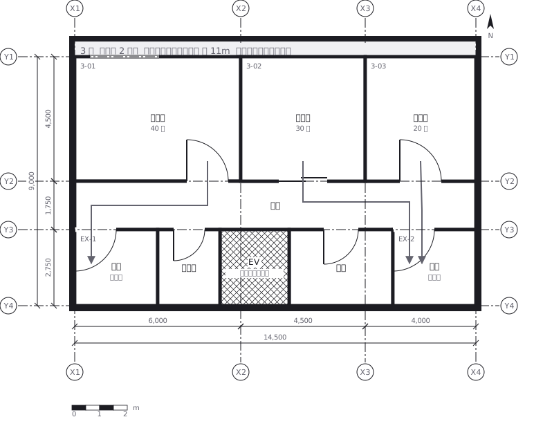 Escape routes on a third floor: two ways out of every room to a staircase, with the travel distance and the fire doors and extinguishers along the way
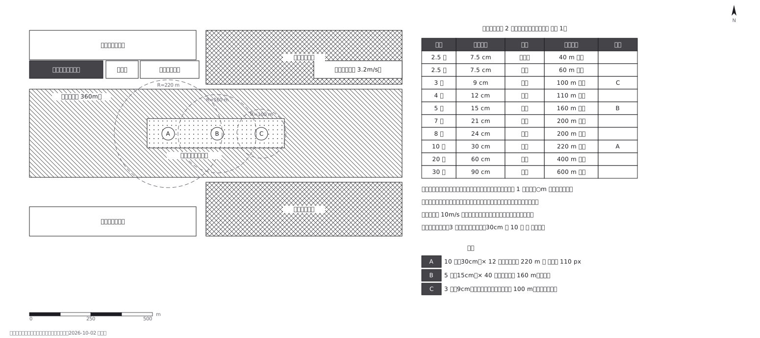 Fireworks safety distances, a circle per shell size
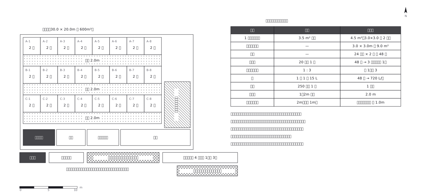 Shelter layout: 3.5 sq m a person, and how many toilets
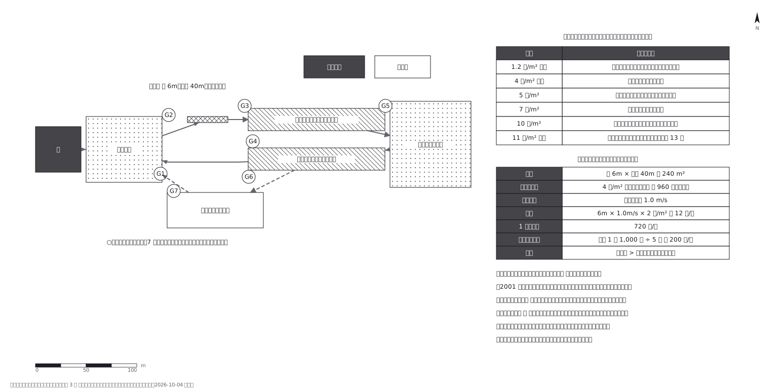 Crowd plan: how many can flow out against how many come in
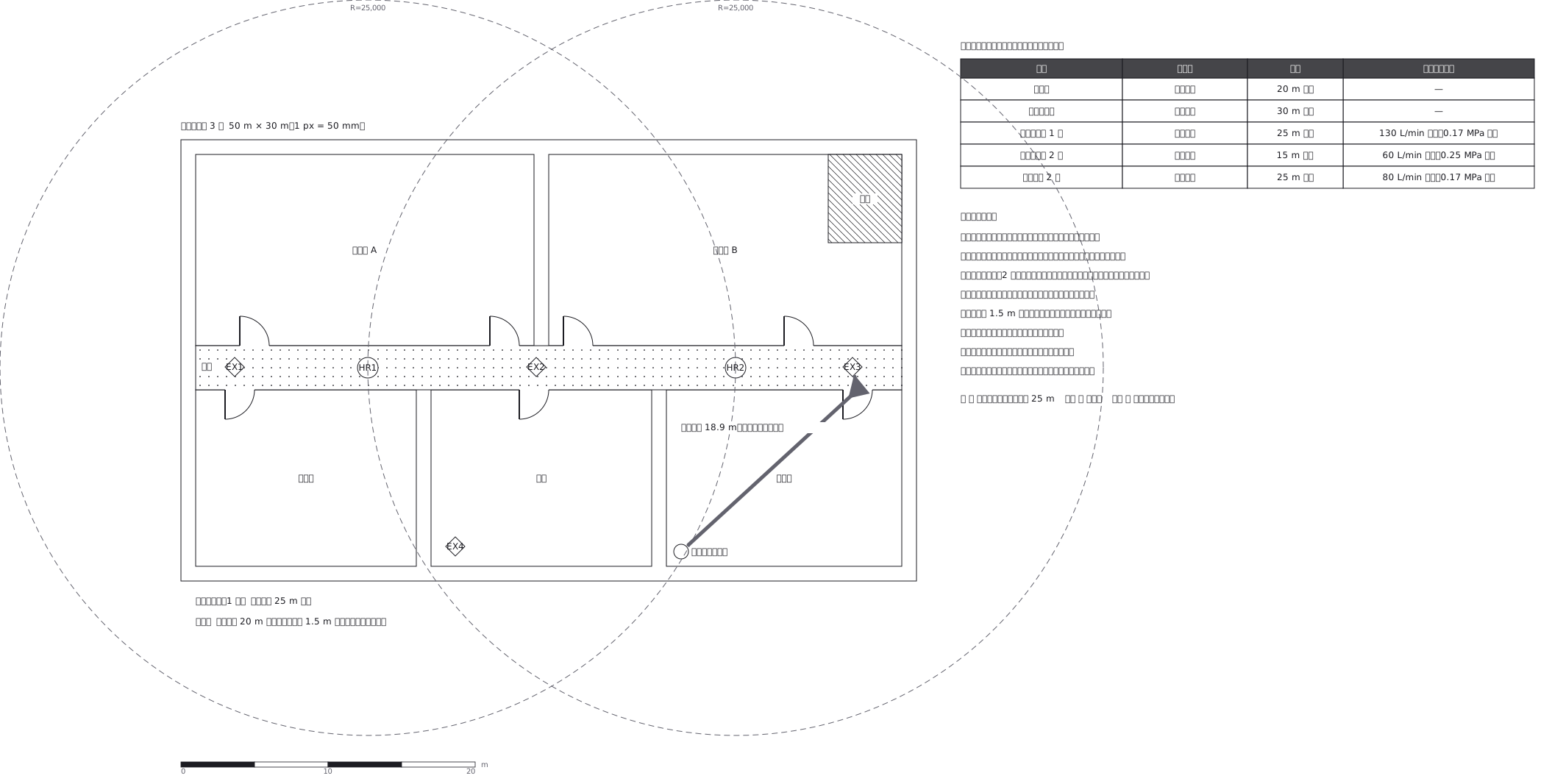 Extinguishers and hose reels, measured two different ways
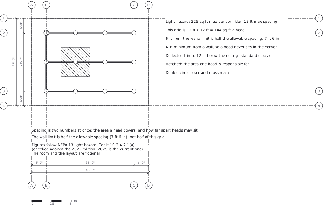 Sprinkler layout: area per head and spacing, decided together
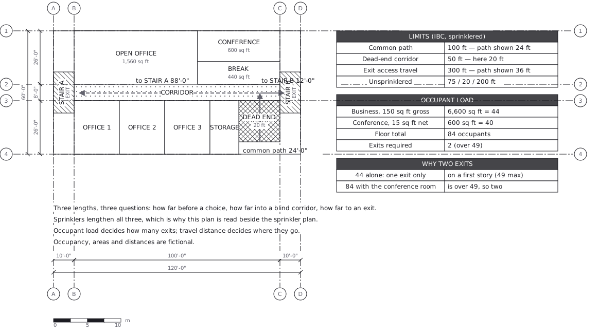 Egress plan: three lengths answering three questions
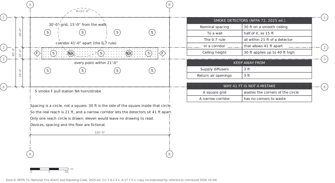 Fire alarm devices: spacing is a circle, not a square