Disaster and emergency
Evacuation decision flow and how to read flood depth
Deciding whether to leave: five questions answered once, in advance — and flood-depth bands read as floors of your own house, not as metres
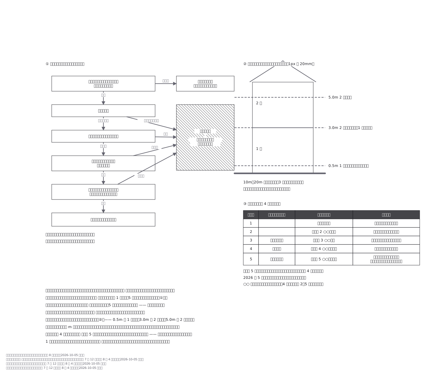
This drawing comes from one YAML file. No shape was moved by hand.
Notes in the source (in Japanese)
わからない人が、自分の家の場合を先に決めておくための図。
決めるのは、強い避難先を作ることではない。ハザードマップを 1 回見て、5 つの問いに答えるだけ。ほとんどの道は「立退き避難」に行く —— 家に留まれるのは例外のほう。
浸水深の色分けは、家の階に合わせて切ってある(0.5m = 1 階の床、3.0m = 2 階の床、5.0m = 2 階が水没)。だから地図の色は「自分の家の何階まで来るか」として読める。
2026 年 5 月 29 日から、気象庁の情報にもレベルの数字が付いた(「レベル 4 大雨危険警報」など。レベル 4 の「危険警報」は新設、「洪水警報・注意報」は廃止)。③の表はその列を足してある。市町村の避難情報(高齢者等避難・避難指示・緊急安全確保)と数字が揃っているので、どちらを見ても同じ段が分かる。4 つの災害とも、レベル 2〜5 が揃っている(気象庁の資料で確かめた):
| 2 | 3 | 4 | 5 | |
|---|---|---|---|---|
| 大雨 | 大雨注意報 | 大雨警報 | 大雨危険警報 | 大雨特別警報 |
| 土砂災害 | 土砂災害注意報 | 土砂災害警報 | 土砂災害危険警報 | 土砂災害特別警報 |
| 河川氾濫 | 氾濫注意報 | 氾濫警報 | 氾濫危険警報 | 氾濫特別警報 |
| 高潮 | 高潮注意報 | 高潮警報 | 高潮危険警報 | 高潮特別警報 |
名前の頭には「レベル 4」のように数字が付く。市町村ごとの洪水警報・注意報は出なくなった。最初は「土砂災害にレベル 5 が無い」と書いた解説記事を信じて「無い段もある」と書いていた。気象庁の資料本体を読んだら、あった。二次資料で食い違ったら、一次資料まで行く。出典:気象庁「新たな防災気象情報について(令和 8 年〜)」。国土交通省 水管理・国土保全局・気象庁「河川氾濫・大雨に関する情報の改善」「土砂災害に関する情報の改善」「高潮に関する情報の改善」(いずれも令和 7 年 12 月、令和 8 年 4 月更新)。
Source (YAML)
examples/gallery/221-避難行動の判定と浸水深.zumen.yaml
More in this field
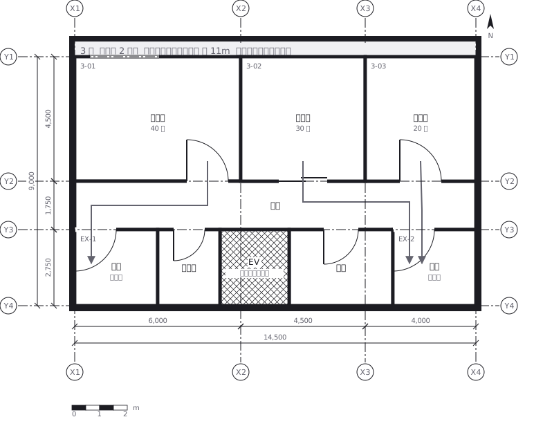 Escape routes on a third floor: two ways out of every room to a staircase, with the travel distance and the fire doors and extinguishers along the way
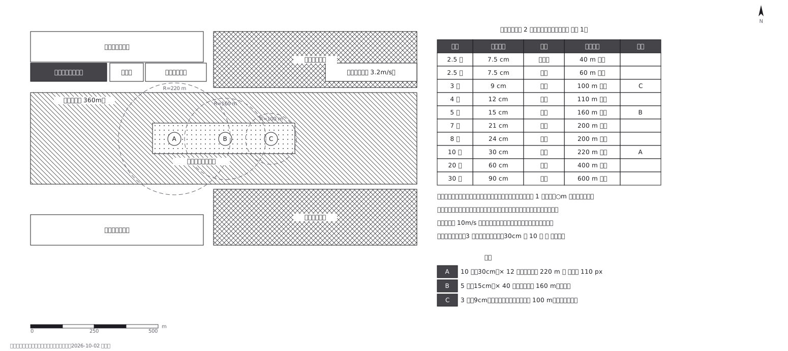 Fireworks safety distances, a circle per shell size
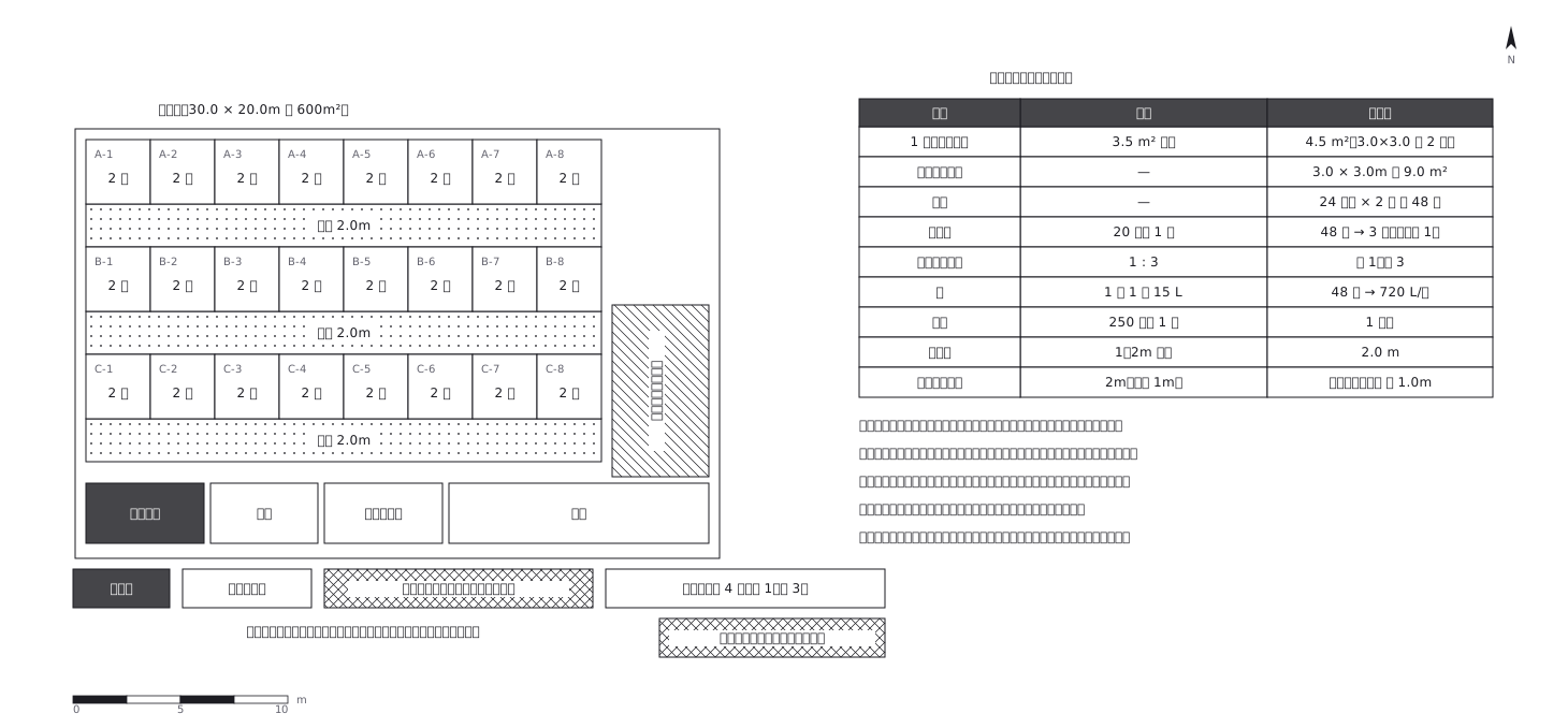 Shelter layout: 3.5 sq m a person, and how many toilets
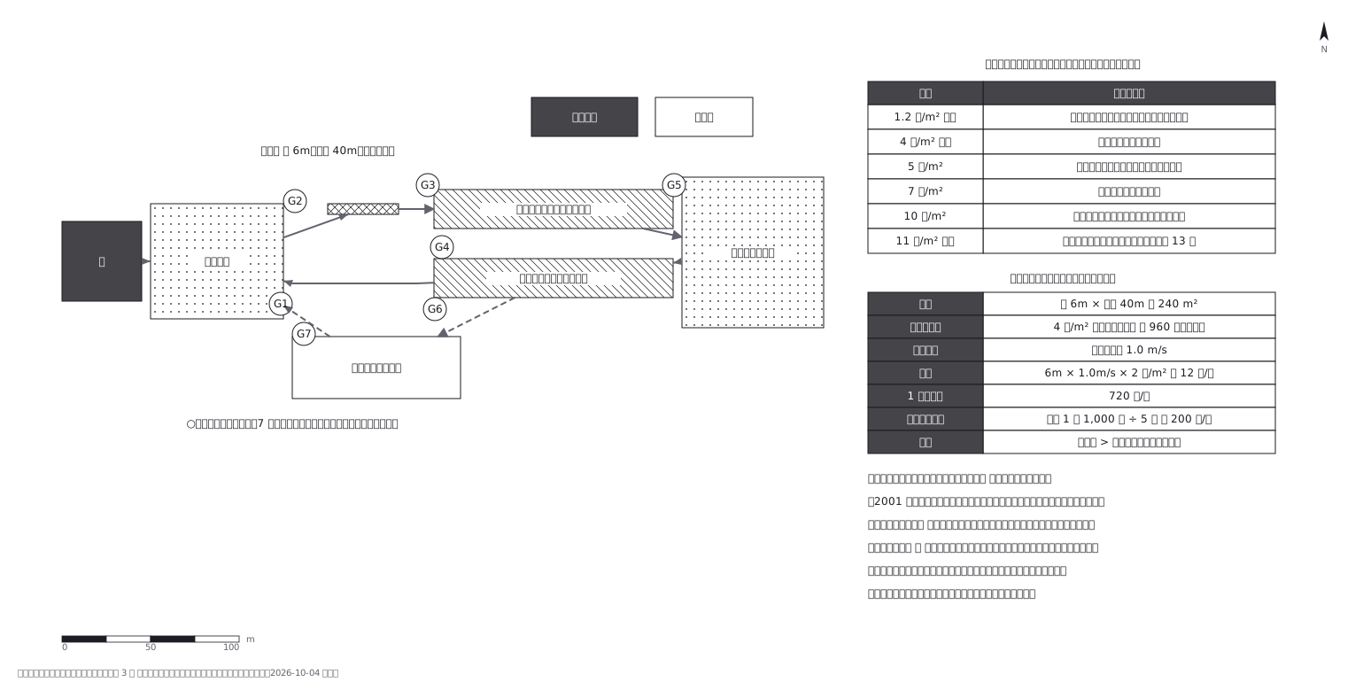 Crowd plan: how many can flow out against how many come in
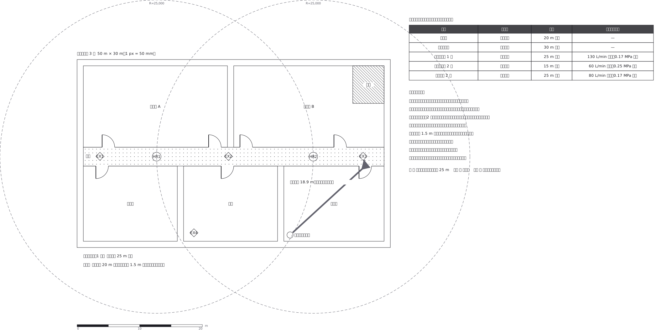 Extinguishers and hose reels, measured two different ways
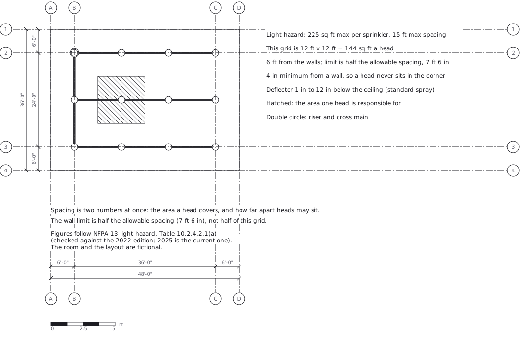 Sprinkler layout: area per head and spacing, decided together
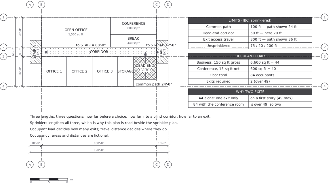 Egress plan: three lengths answering three questions
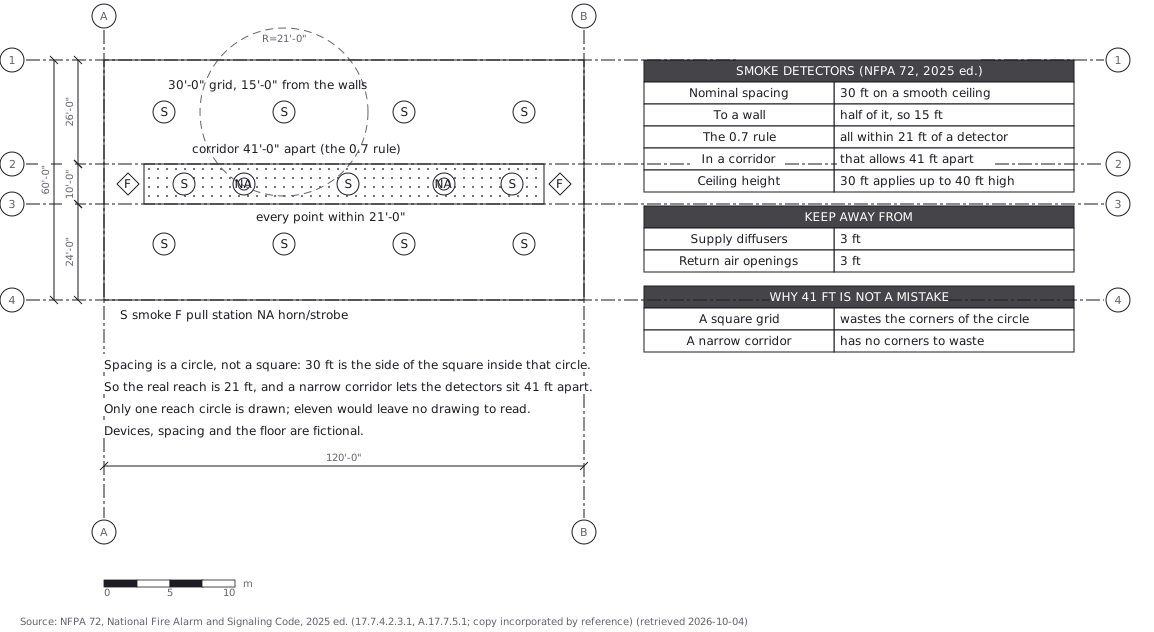 Fire alarm devices: spacing is a circle, not a square